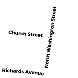
43 S WASHINGTON ST
Owner Information
INHABITANTS OF TOWN OF NORTH ATTLEBOROUG
43 S WASHINGTON ST
N ATTLEBORO, MA 02760


Property Details
43 S WASHINGTON ST is classified as a SELECTMEN-IMPRVD (City/town hall).
The primary structure on this property was built in 1978. There are 40,573ft2 of built area within this property. There is 23,642ft2 of residential/living space within this property.
43 S WASHINGTON ST is valued at $5,776,200. The land is valued at $589,200 and the structures are valued at $4,817,600. There is an additional valuation of $369,400 on this property.
This property is in Zone C7.5. Confirm with local Zoning Board authorities to ensure there are no overlays or other easements on this property.
The most recent deed for 43 S WASHINGTON ST is recorded at the local registrar in Book 00806, Page 0252. 43 S WASHINGTON ST was last sold on Monday, June 1, 1931 for $0.
Assessment data from fiscal year 2022.
Flood Data
According to the FEMA National Flood Hazard Layer, this property does not appear to be in a flood zone. It may also be in an area not yet reviewed. Nonetheless, confirm this information prior to taking any action.
To view the flood hazards around this property, create a FEMA "Firmette" Map of the area around 43 S WASHINGTON ST.
Broadband Internet Providers
| Provider | Type | Bandwidth (mbps) | |
|---|---|---|---|
| Comcast | Cable | 1000 | 35 |
| GCI Communication Corp. | Satellite | 0 | 0 |
| Verizon New England Inc. | DSL | 15 | 1 |
| VSAT Systems, LLC. | Satellite | 2 | 1 |
| HughesNet | Satellite | 25 | 3 |
| Viasat Inc | Satellite | 100 | 3 |
| Verizon New England Inc. | Fiber | 940 | 880 |
| TPx Communications | Copper Wire | 0 | 0 |
Broadband service provider data from December 2020.